 SWOT Weather Propagation Page
National Weather Service Radar Links for Temperature Inversion Detection
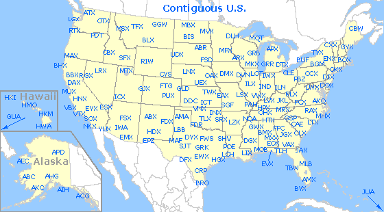
Click on the map to see it full scale and link to other regions or a specific radar.
NEXRAD WSR-88D RADARS UNITED STATES

NWS NATIONAL RADAR MOSAIC

USA Radar - Active Weather
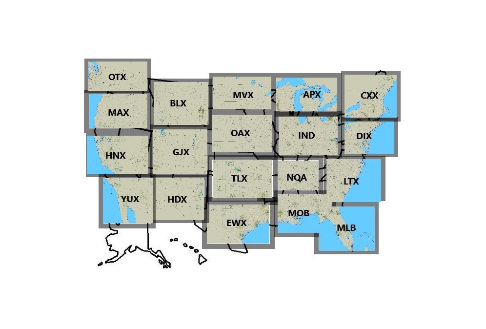
Regional NEXRAD Radar Map (Temperature Inversion Detection)
NOTE: THE RADAR IMAGES SHOWN ARE NOT REALTIME.
CLICK ON THE IMAGE BELOW FOR THE LATEST REGIONAL RADAR DISPLAY.
NEXRAD REGIONAL RADAR LOOPS - SOUTHEAST QUADRANT U.S.A.

EWX SAN ANTONIO NEXRAD REGIONAL RADAR

MOB MOBILE NEXRAD REGIONAL RADAR

MLB MELBOURNE NEXRAD REGIONAL RADAR

TLX OKLAHOMA CITY NEXRAD REGIONAL RADAR

NQA MEMPHIS NEXRAD REGIONAL RADAR

LTX WILMINGTON NEXRAD REGIONAL RADAR
NEXRAD REGIONAL RADAR LOOPS - NORTHEAST QUADRANT U.S.A
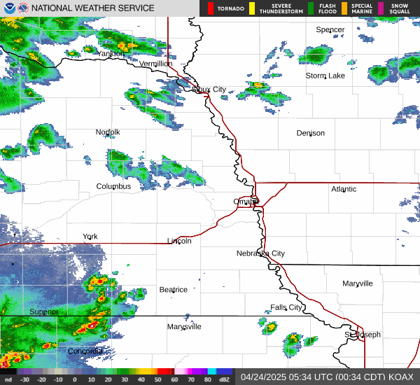 OAX OMAHA NEXRAD REGIONAL RADAR
 IND INDIANAPOLIS NEXRAD REGIONAL RADAR
 DIX PHILADELPHIA NEXRAD REGIONAL RADAR
 MVX GRAND FORKS NEXRAD REGIONAL RADAR
 APX GAYLORD MI NEXRAD REGIONAL RADAR
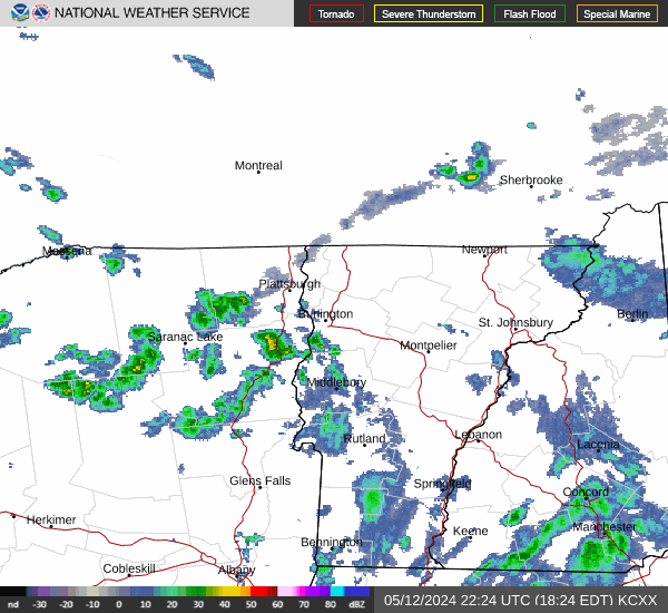 CXX BURLINGTON VT NEXRAD REGIONAL RADAR
NEXRAD REGIONAL RADAR LOOPS - SOUTHWEST AND NORTHWEST QUADRANTS U.S.A
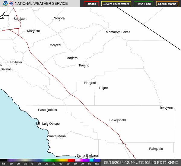 HNX HANFORD CA NEXRAD REGIONAL RADAR
 GJX GRAND JUNCTION CO NEXRAD REGIONAL RADAR
 YUX YUMA AZ NEXRAD REGIONAL RADAR
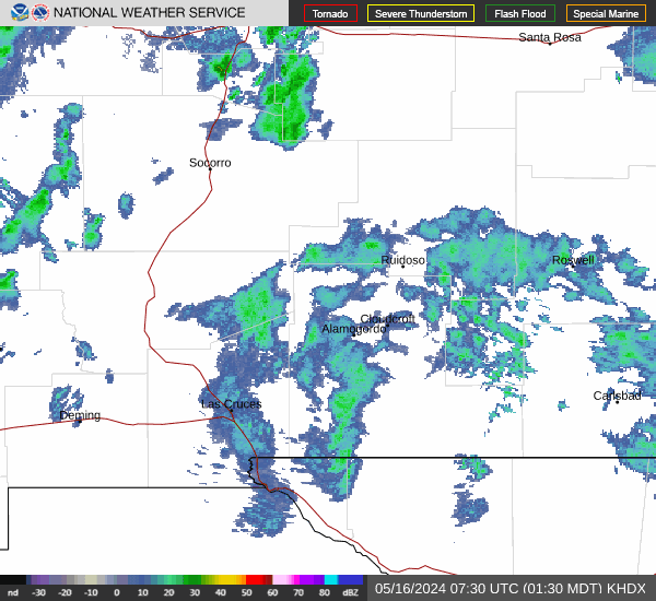 HNX ALAMOGORDO NM NEXRAD REGIONAL RADAR
 OTX SPOKANE WA NEXRAD REGIONAL RADAR
 MAX MEDFORD OR NEXRAD REGIONAL RADAR
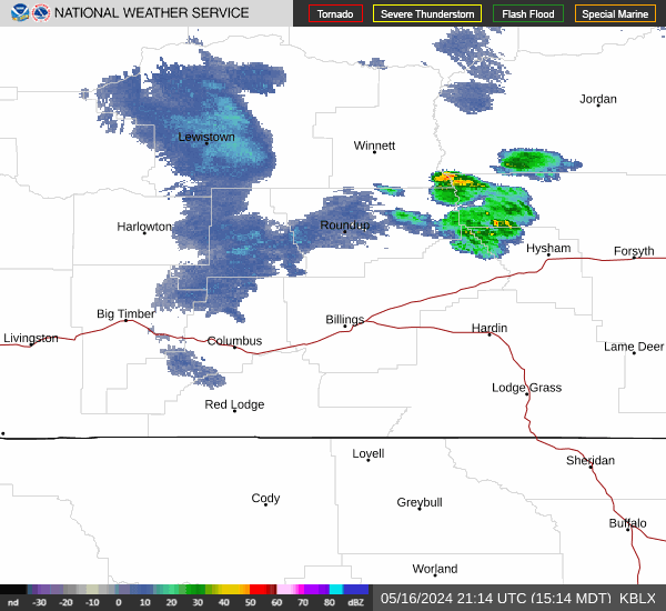 BLX BILLINGS MT NEXRAD REGIONAL RADAR
Click on the map to see it full scale.
Upper Air Maps at Various Levels and Prediction Loop
Real-Time Surface Winds
CLICK ON THE LINK AND IDENTIFY AREAS LESS THAN 1 MPH SURFACE WINDS
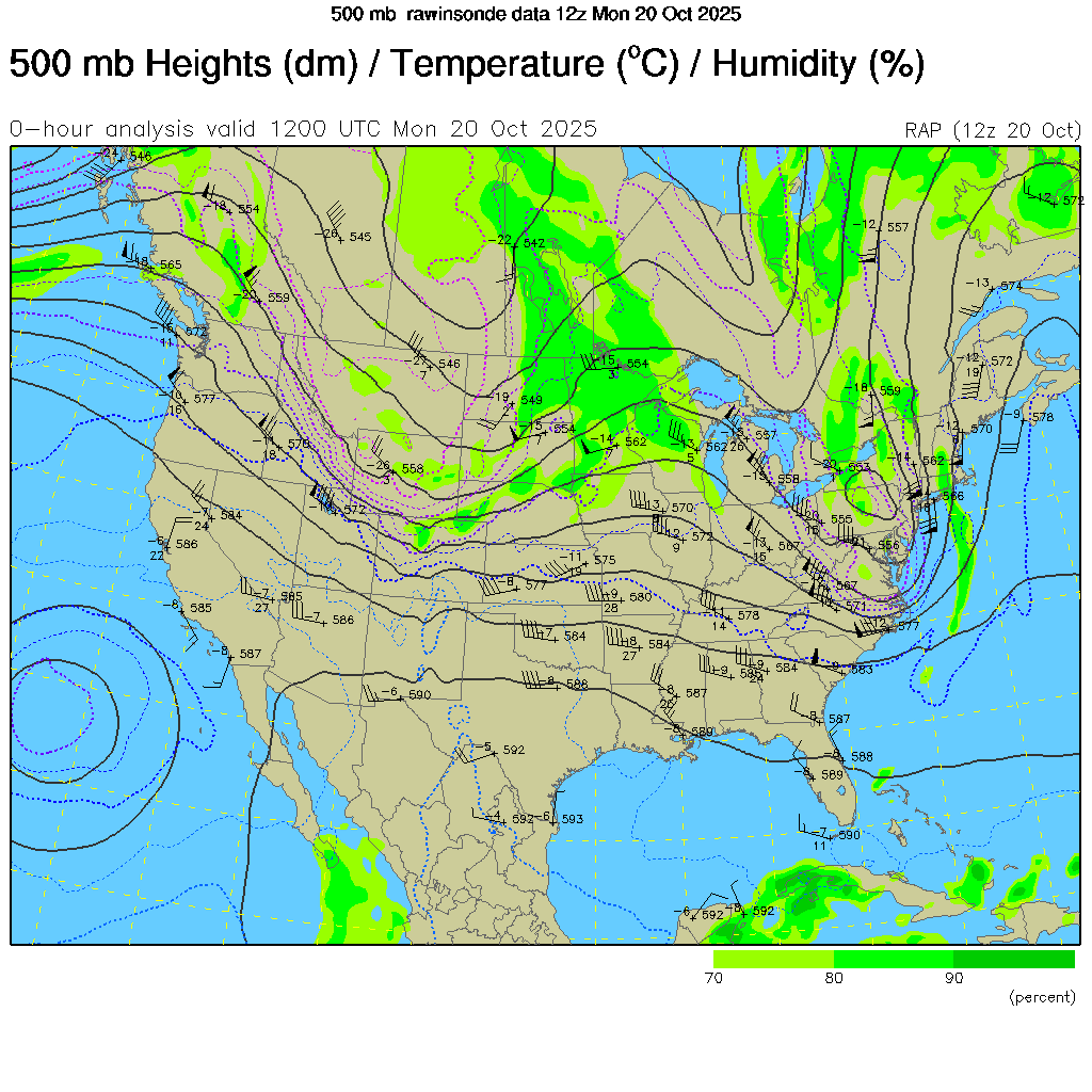 500 mb Height/Temperature
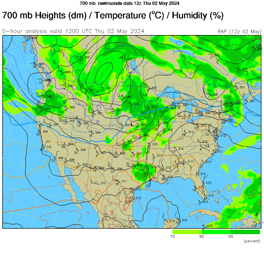 700 mb Height/Temperature
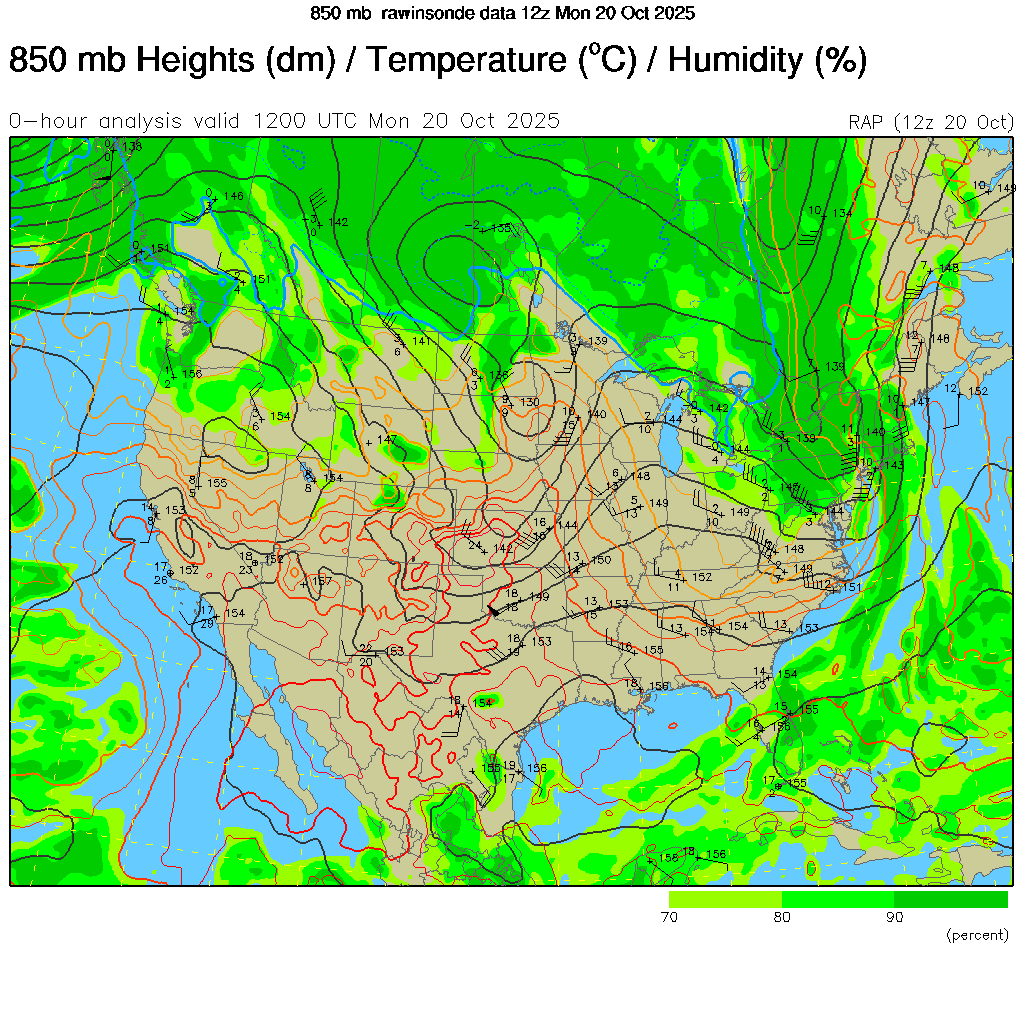 850 mb Height/Temperature
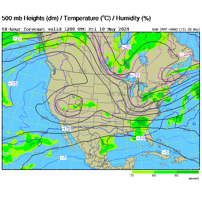 84 Hour 500 mb Height/Wind Projection Loop
Click on the chart or image to see it full scale.